Products
Evan-Moor Educational Publishers
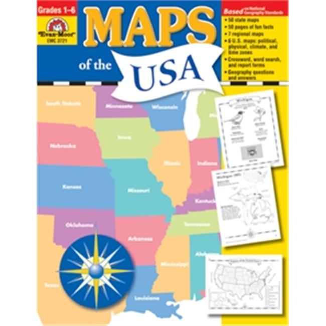
Evan-Moor Educational Publishers 3721 Maps Of The USA
Upgrade to unlock this product- Shipping Cost (lower 48): $7.06
- SKU: EMEF608
- Asin: 1557999554
- Manufacturer Part #: 3721
- Qty Available: 17
- Shipped By: 7 days
- Stock: In Stock
Please login to view pricing details.
Product Description
Maps of the USA has been updated and expanded! You'll find geopolitical maps of each of the fifty states; political maps of the six regions; and political, physical, and thematic maps of the United States. You'll also find fun facts, geography bee-type questions, and review pages.
- Dimension - 11 x 0.29 x 8.5 in.
- Page Count - 128
The Fifty States
- The state capital
- Two most populous cities
- Major rivers, mountains, and deserts
- And state borders
- An outline map of the states in that region
- A small inset map of the United States with the region highlighted
- Five questions about the region
- And a challenge research question
- 1 Political reference map of the six regions of the United States
- The fifty states, labeled and blank maps
- Mountains and deserts
- Waterways
- Climate zones
- Time zones
- Maps showing the location of the United States in North America and the World
- A study sheet that includes ten questions about the map and a challenge research question accompanies each map
 upgrade to unlock this product
Press CC5500 American Civil War
upgrade to unlock this productPress CC5501 World War I
upgrade to unlock this productPress CC5502 World War II
upgrade to unlock this productPress CC5505 Korean War
upgrade to unlock this productPress CC5506 Vietnam War
upgrade to unlock this product